- English
Languages:
This site is created using Wikimapia data. Wikimapia is an open-content collaborative map project contributed by volunteers around the world. It contains information about 32590649 places and counting.
Learn more about Wikimapia and cityguides.
Georgetown
Georgetown, Guyana's Capital City and chief port, is situated on the right bank of the estuary of the Demerara River. The site was originally chosen as a Fort to guard the early Dutch settlements of the Demerara River.
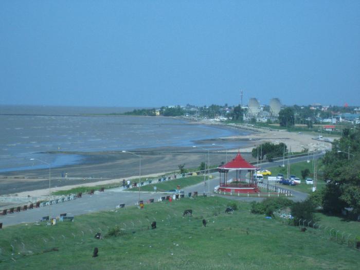
The city lies below sea level and is protected from the Atlantic Ocean by the sea wall which was originally built in two phases. The first phase, up to the Roundhouse, was completed in 1860 and the second phase, extending to Kitty, was undertaken from 1872 to 1882. At the western end of the sea wall is a bandstand which was built in 1903.
Georgetown is over two hundred years old. In 1781, the British military administrator of the recently captured colony of Demerara, Lieutenant Colonel Robert Kingston, established Fort St. George as his headquarters in a portion of the area presently known as Georgetown.
The French gained control of the colony of Demerara in 1782. They demolished Fort St. George and built a new centre called Longchamps (La Nouvelle Ville). In 1784, the Dutch were once again in control of the colony of Demerara and they changed the name of their colonial capital from Longchamps to Stabroek.
In 1796, the Dutch relinquished control of Demerara to the British who continued to hold it up to 1966, except for a brief period from 1802 to 1803 when the Dutch were in control. Stabroek was renamed George Town in 1812, after the British Monarch, King George IV. George Town became the city of Georgetown by "Royal" warrant in 1842.
The boundaries of Georgetown were extended in 1970 to include Sophia, Lilendaal, Pattensen, Turkeyen and Cummings Lodge, eastward on the East Coast, Ruimveldt, and parts of Huston and Rome, southward on East Bank, Demerara.
The present area of Georgetown is about 40 square kilometres in comparison to about 6 square kilometres before the expansion in 1970 under the Municipal and District Councils Act.
The city of Georgetown is laid out in a rectangular pattern with tree-lined avenues, drainage canals and sluice gates (kokers). Most of the city's historical buildings are wooden in construction.
A tour of Georgetown provides several examples of the city's colonial architecture (eighteenth and nineteenth century), its monuments, statues, bandstands, markets, gardens and museums, some of which are discussed below.
The present site of Stabroek Market, sometimes referred to as Big Market, is near to an open-air market where slaves were allowed to sell plantains on Sundays only, beginning in 1792. The market was named after an early settlement at the mouth of the Demerara River. This settlement was named Stabroek in 1783 after Nicholas Geelvinck, Lord of Capiscum, Bakum and Stabroek, the then president of the Dutch West India Company.
The existing structure of wood, concrete, zinc and iron occupies about 0.9 hectares on both land and water. The corner stone for the market was laid on July 17, 1880 by Mrs. Kortwright, the wife of the Governor, Cornelius Kortwright. Stabroek Market was officially opened on November 1, 1881.
The famous four-faced clock, which stands almost 31 metres above ground level was manufactured in the United States and installed on its tower above the market in 1881. The market was designed and built by two American firms. Once described as Bizarre Bazaar, anything from gold jewellery to fruits and vegetables can be found in the market.
Other municipal markets are Bourda (1880), La Penitance (1925; in Albouystown) and Kitty.
Parliament Building, also known as Public Buildings, houses Guyana's Legislature or National Assembly and was designed by Joseph Hadfield. The foundation stone was laid in 1829 and the Building was completed in 1834. At this site, Guyana's slaves purchased for the first time, their own land. The street south of Parliament Building, Hadfield Street, was named after the Building's architect, Joseph Hadfield.
The Hubert Critchlow Monument on the lawns of the compound of Parliament Building was unveiled on December 2, 1964 by the then Premier, Cheddi Jagan. It is a tribute to Hubert Nathaniel Critchlow, the father of the Trade Union movement in Guyana. The bronze sculpture of the late trade unionist by Edward Burrowes is mounted on a two-metre high pedestal.
The High Court, also called the Victoria Law Court, was designed by Cesar Castellani and opened on May 24, 1887. In front of the High Court is a statue of Queen Victoria which was unveiled on September 4, 1894 by the Governor, Sir Charles Lees. The statue was moved to the compound of the City Engineer's Department in 1990 and subsequently returned to the compound of the High Court.
City Hall houses the administrative offices of the City of Georgetown. This building is a splendid example of Gothic architecture, designed by the Very Reverend Father Ignatius Scoles S.J. The foundation stone was laid on December 23, 1887 and the building was declared opened by Governor Gormanston on July 1, 1889. Adjacent to City Hall is the City Engineers Department.
The building housing the Hand-in-Hand Mutual Fire Insurance Company Limited, at the corner of the Avenue of the Republic and North Road, was built during 1878 and 1879. Its cast-iron ornamentation includes arches, stairs and railings with distinctive floral designs typical of the Victorian era in Britain.
The National Museum is located on North Road in a building complex which opened in 1951. The Museum's collections were housed previously in the Carneige Building.
Other museums in the city include the National Military Museum at Camp Ayanganna, Thomas Lands, the Police Museum at the Police Force Headquarters, Eve Leary, and the Museum of African Art in Barima Avenue.
The Monument to the Non-Aligned Movement ¹ at Company Path, east of the Hand-in-Hand building, is a tribute to the founding leaders of the Non-Aligned Movement. It was unveiled in 1972 by the first President of Guyana, Arthur Chung, and includes busts of Gamal Abd-Al Nasser of Egypt, Kwame Nkrumah of Ghana, Jawaharlal Nehru of India, and Josip Broz Tito of Yugoslavia.
St. George's Cathedral ¹ is the mother church of the Anglican Diocese in Guyana. It is one of the tallest, free-standing wooden buildings in the world with its spire over 40-metres high. The building was designed by Sir Arthur Bloomfield and the foundation stone was laid on November 21, 1889. The Cathedral was opened by Bishop William Piercy Austin on August 24, 1892 and dedicated by Bishop P. Swaby on November 8, 1894.
Other places of worship in Georgetown include:
• Cathedral of the Immaculate Conception: Front Back (Catholic)
• Church of the Sacred Heart (Catholic)
• Queenstown Jama Masjid (Muslim Mosque)
• Christ Church
• St. Andrew's Kirk (Presbyterian)
The Cenotaph or War Memorial, at the southern end of Main Street, is close to the Bank of Guyana Building and the National Library. The marble monument, about 4.5-metres tall, is a memorial to those who died in the first and second World Wars.
The National Library, formerly known as the Georgetown Public Free Library, was opened in 1909. The construction was funded by a Scottish-born American philantropist Andrew Carnegie after whom the building was named.
Also on Main Street are a branch of the National Archives, Courts Guyana Inc. and Hotel Tower. Other commercial enterprises along Main Street include Palm Court Restaurant and Main Street Plaza Hotel.
Anthopological and archaeological information on Amerindian life in Guyana is housed in the Walter Roth Museum of Anthropology on Main Street, near the State House.
The State House is the official residence of the President of Guyana. The original structure was built in 1845 and it was known as Government House, the home of the Governors of British Guiana for over 100 years.
The Prime Minister's Residence on Main Street was formerly owned by Booker Brothers. It has been said that the Director of Bookers would watch the ships come in from this house and that the captains were aware of this and would ensure that the port side of their ships were always painted.
The Red House ¹ on High Street, a wooden building with red-painted shingles, was the residence for British Colonial Secretaries in British Guiana. The former Presidents of Guyana, Dr. Cheddi Jagan and his wife Janet Jagan, lived in the building while Dr. Jagan was Premier of British Guiana from 1961 to 1964. The building is now the home of the Cheddi Jagan Research Centre which was officially opened on March 22, 2000.
The Umana Yana and the Liberation Monument ¹ are located at the northern end of High Street a short distance from Le Méridien Pegasus Hotel. The Umana Yana or meeting place of the people is a thached benab built by the Wai Wai Indians for the Heads of the Non-Aligned Movement Conference in 1972.
The Liberation Monument was unveiled in the forecourt of the Umana Yana during 1974. The monument commerates solidarity with the African Liberation Movement and consists of five pillars of greenheart of irregular height and a slab of granite with pebbles around its base.
The Lighthouse, a brick and concrete structure about 31-metres tall, was built by the British in 1830 near the mouth of the Demerara River. It is the country's only lighthouse and guides ships into Port Georgetown with its revolving light.
The National Park in Thomas Lands, formerly known as Queen Elizabeth Park, was opened by Queen Elizabeth II on February 5, 1966. Within the park are the Burrowes School of Art with a sculpture of Edward Burrowes on its roof, a sculpture in honour of scouting in Guyana and the Children's Millennium Monument.
The Children's Millennium Monument was unveiled by former President Janet Jagan on March 15, 2000. It consists of a hemisphere at the base, an upside-down 'L' and the rising sun at the top of the structure. The vertical portion of the upside-down 'L' signifies the strength and growth of children, the shorter horizontal portion of the 'L' reflects the unlimited potential of children and the rising sun signifies the development of children.
An inscription on the hemisphere at the base reads as follows, "Every child has the right to, A Name and Nationality, A Family, Healthcare, Education, Play ..." There are six benches around the monument representing the six races of Guyana. The monument was designed by the artist Michael Khan.
The Promenade Garden, with its main entrance on Middle Street, occupies one city block. The area was once used as a public display for hanging the slaves associated with the 1823 East Coast rebellion. Prominent fixtures in the garden include a bandstand and the Mahatma Gandhi Monument. The bandstand is the oldest of three in the city and was completed in 1897. The monument was unveiled on October 2, 1969 by Governor General, Sir David Rose.
Opposite (south of) the Promenade Garden is Independence Square, formerly known as Parade Ground. A monument to commemorate Emancipation will be erected in the square later this year.
The Indian Immigration Monument is located in a garden delimited by Camp, North, Alexander and Church Streets. The monument, a bronze replica of the vessel Whitby resting on a rectangular base, was unveiled on May 6, 1997 in commemoration of the arrival of the first East Indians in British Guiana. The vessel was one of two which brought the immigrants to the country on May 5, 1838.
In the block bounded by Regent Street, New Garden Street and North Road is the Georgetown Cricket Club (GCC), commonly known as Bourda, where International Cricket matches are played. Cricket is one of the national sports of Guyana and Bourda is the only international cricket ground below sea level.
The Botanical Gardens on Vlissengen Road was originally laid out in 1879. It includes the Zoological Park, which was opened in 1952, parklands, flower gardens and a bandstand. A wide variety of birds, mammals and reptiles can be found in the Zoological Park. The roadways of the Botanical Gardens are lined with palm trees and manatees live in artificial lakes across which are bridges known as the Kissing Bridges.
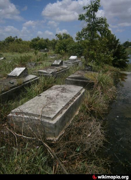
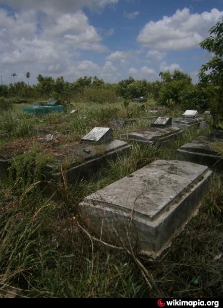
Recent additions to the Botanical Gardens are the Seven Ponds Monument (1969) and the Mausoleum (1986). Sir David Rose, the first Guyanese Governor General, and Martin Carter, a Guyanese poet, are buried near the Seven Ponds Monument. The body of the First Executive President of Guyana, Forbes Burnham, is entombed in the Mausoleum. Sculptures by Ivor Thom, depicting the life and times of the late President, cover portions of the Mausoleum's interior walls.
At the corner of Vlissengen Road and Homestretch Avenue is the Castellani House, formally named in 1993 after its architect, Cesar Castellani. The original building was constructed during 1879 to 1882 and was the residence of the Government Botanist George Jenman beginning in 1883. Forbes Burnham resided there from 1965 until his death in 1985, during his tenure as Prime Minister and later, President of Guyana. The Castellani House is the home of the National Art Collection.
An array of watercolours, oil on canvas, and pen and ink drawings by some of Guyana's artists are also on display in the Fine Arts Gallery of the Hadfield Foundation located on Hadfield Street.
The National Independence Monument, on Brickdam, near Vlissengen Road, is a gift to the people of Guyana from the Demerara Bauxite Company (DEMBA) commemorating Guyana's Independence from Great Britain on May 26, 1966. The structure, in the form of an arch, consists of three tubes made of aluminum from Guyana's bauxite mounted on a quartz base. The arch was designed by a Canadian engineer, Edric Klak.
A short distance east of the National Independence Monument, in the Square of the Revolution, is the 1763 Monument ¹ with a statue of Cuffy who led the 1763 slave rebellion at Plantation Magdalenenburg in Berbice. The bronze statue is the work of the sculptor Philip Moore. It is 5-metres high and rests on a concrete foundation designed by the architect Albert Rodrigues.
At the corners of Mandela and Homestretch Avenues is the National Cultural Centre where theatre productions and concerts are held. It was opened in 1976. Poetry readings and plays were also staged by the Guyana Theatre Guild at the Kingston Playhouse.
Wikipedia article: http://en.wikipedia.org/wiki/Georgetown,_Guyana
Georgetown, Guyana's Capital City and chief port, is situated on the right bank of the estuary of the Demerara River. The site was originally chosen as a Fort to guard the early Dutch settlements of the Demerara River.
The city lies below sea level and is protected from the Atlantic Ocean by the sea wall which was originally built in two phases. The first phase, up to the Roundhouse, was completed in 1860 and the second phase, extending to Kitty, was undertaken from 1872 to 1882. At the western end of the sea wall is a bandstand which was built in 1903.
Georgetown is over two hundred years old. In 1781, the British military administrator of the recently captured colony of Demerara,...
 Reduce description
Georgetown on the map.


Recent city comments: